Irish Sea Rim Environmental and Scientific Observatory (ISRESO)
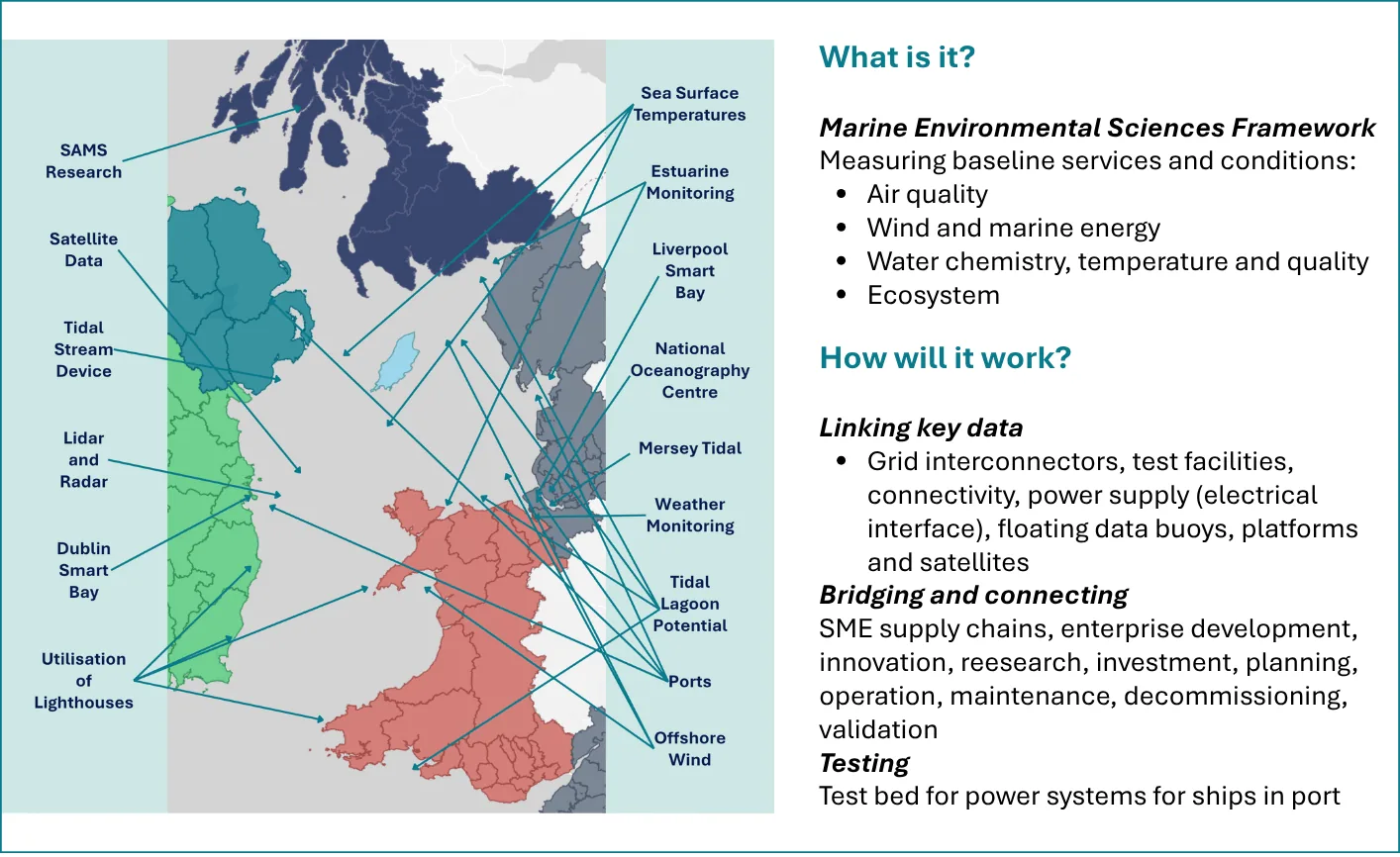
The Irish Sea Rim proposes to develop an Environmental and Scientific Observatory around the Irish Sea that will act as a Marine Environment Services Framework to measure baseline parameters of the geographical area of the Irish Sea and assess the potential for energy projects. Data collection will include air quality, wind and wave potential, weather data, water quality, the ecosystem and environment, and the underpinning economies and supply chains.
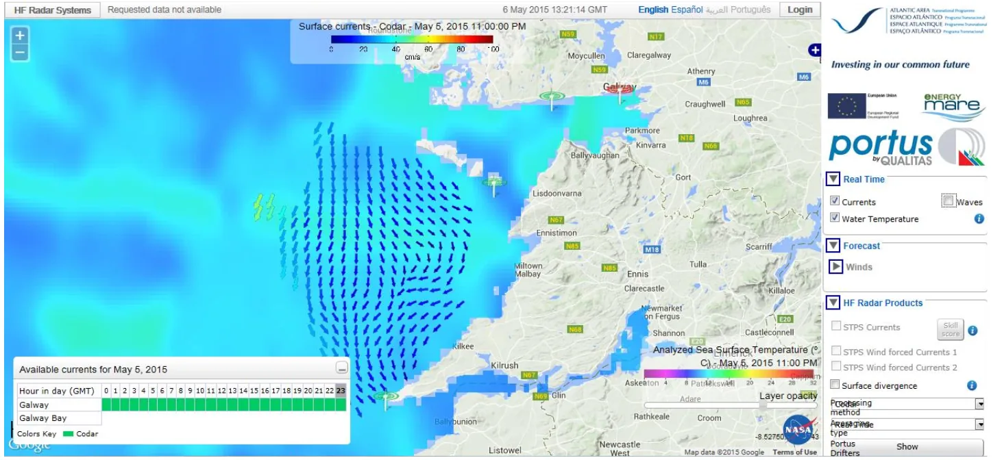
There are many scientific measurements and observations collected and mapped in and around the Irish Sea. These range from sea state, water chemistry, tidal current measurement, weather, radar, lidar and many other wide-ranging parameters. Currently, many of these are not well connected. This project will engage and link across a number of projects and activities to enable the building of a clear and comprehensive platform of scientific measurement in the region. This will support the development of improved connectivity of data sets and informed decision making with regard to Irish Sea energy installations and coastal infrastructure.
Natural estuarine environments are dynamic and are in a constant state of flux, naturally changing over time. As a result, these environments are particularly vulnerable to external interventions. Erecting a bridge or installing a tidal barrier will lead to changes in the local environment and, over time, this may impact the tides and channels within the estuary. Civil infrastructure in an estuary can have a positive and/or negative effect, such as causing the channel to silt up, and without accurate mapping and records, there is no way to accurately estimate or evaluate the effect of installation of an energy device.
A data-based model will be developed from the measured parameters, with additional economic data also analysed. Assessment of the economics of renewable and other energy devices is a key driver in determining whether the technology and device are installed in a particular location and environment. This combination of data sources will underpin a multi-layered sequential decision-making model. This will also facilitate the development of an advanced supply and value chain that will create jobs and economic growth.
WHAT ISRESO WILL MEASURE
ISRESO will monitor estuarine regions, particularly in areas where energy and or infrastructure projects are proposed. This monitoring would continue both during and post installation of any key energy stations such as a tidal device (lagoon, bridge, fence, etc.) It will also address policy with respect to shipping routes and sulphur dioxide emissions. Scientific and environmental monitoring, combined with economic modelling, can support the assessment of the environmental and economic parameters for any developed and installed technology. Critically, this monitoring will occur in three phases:
- PRE-INSTALLATION MONITORING: To measure and monitor the natural environment as accurately as is possible with current devices prior to any civil engineering work. A time series of data will be collected, mapped, and monitored. This will enable a picture of the area to be created, allowing the potential impacts of the installation of tidal and marine energy devices to be modelled and evaluated.
- ACTIVE INSTALLATION MONITORING: Measuring and monitoring the environment during construction of tidal and marine devices will allow the overlaying of data over pre-installation models, enabling the discovery of any status changes and impacts to the local area arising from installation of any structural devices. Combining these measurements with economic data (including time and cost overruns) will be vital to gain an accurate picture of the true cost and economic benefit.
- POST-INSTALLATION MONITORING: Continued monitoring of natural environment and economic data once any tidal or marine structures have been installed will be critical, not only to assess the impact of that structure, but also to build up a more detailed bank of data to support environmental and economic impact modelling and planning for future projects.
ISRESO GEOGRAPHICAL REGION
ISRESO will include all Irish Sea Rim member countries and will also include the North Channel (north of the Irish Sea) and the area of the Celtic Sea in the region of South West Wales and South East Ireland (Figure 13.1).
HOW ISRESO WILL WORK
ISRESO will monitor data from grid interconnectors, test facilities, data acquisition, supply chain, enterprise development, innovation, research, investment, environment, planning, operational, maintenance, decommissioning, validation, connectivity (Internet), power supply (electrical interface), floating data buoys, and platforms. Other relevant data sources will include the use of lighthouses situated around the Irish Sea Rim as scientific laboratories to house monitoring equipment.
Innovation will be a key aspect of ISRESO in helping to solve the challenges of developing and installing energy devices in harsh marine environments, and advances in drone technology may be key to this. We will work closely with universities with an environmental and maritime focus.
This will be a big data project, and it is envisaged that ISRESO will be able to develop a holistic interconnected model that can encompass many of the key environmental and logistical areas, such as environment impact statements, planning, fisheries reports, and emissions from shipping that can help shape policy and ultimately support the UK and Ireland to demonstrate global leadership in marine energy planning. The project will require a matrix funding model from multiple sources, phased over a number of years. The project lifetime is planned to continue over a 20-year timeframe, allowing long time series of environmental data to be collected, mapped and researched. Preliminary projects may form part of the planned Irish Sea Rim Doctoral Training Centre (Section 15).
This will be a partnership across the quadruple helix, encompassing national and regional governments, industry, academia and place. In addition to research, this project could support education and employment opportunities for under-resourced schools and communities, particularly in coastal areas.
The Irish Sea Rim Environmental and Scientific Observatory will be a driver of significant regional growth, supporting the region’s aim to provide an economic and technical counterbalance to London and the Greater South East as well as the creation of a world-leading supply chain in Marine Technology. This will be created through the development of manufacturing expertise around the Irish Sea Rim that will develop the capability to export this expertise.
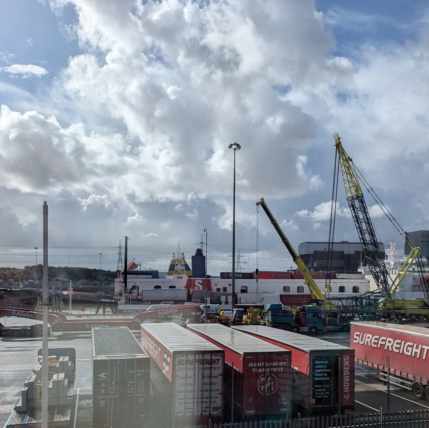
Logistics and Activity at Heysham Port, Image credit: Irish Sea Rim